
Tank Warfare Illustrated Atlas: From 1916 to the Present Day
Usually shipped within 24 hours
UK deliveries from £4.99 postage
Taxes and duties displayed at checkout
Delivery & Returns
Delivery & Returns
We use the Royal Mail, DHL Express or UPS for our customers. For UK addresses, deliveries under 10kg are a standard £4.95 via Royal Mail Tracked 48 Service. For orders over 10kg and overseas customers, postage is calculated for you at checkout once you have entered your postal address. This price, does not include any potential custom charges that may apply, depending on the product or destination, as every country has very different import duties / taxes. Online exclusive products (such as trainers) will be delivered to you directly from the printer, separate from other items in your order, but your postage fee covers ALL items in your order.
If you are unhappy with your purchase, please email shop@tankmuseum.org within fourteen (14) working days of receiving your goods, and return it to us at the address below, in its original condition, unopened (with any seals and shrink-wrap intact) and we will issue you a full refund or replace it. Goods must be returned at your own cost. If the item is faulty, you do not need to return it, we will send you a replacement free of charge.

Tank Warfare Illustrated Atlas: From 1916 to the Present Day
Description
Description
By Dr Stephen Hart
Hardback
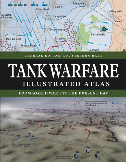
The Tank Warfare Illustrated Atlas is a highly illustrated and accessible account of the development of tank warfare, from World War I to the present day.
Featuring more than 120 complex computer-generated battle maps and graphics, the book ranges from the first significant use of tanks at Cambrai during World War I through to major tank battles of World War II, the Indo-Pakistan War, the Arab-Israeli Wars, the Iran–Iraq War, the Allied invasions of Iraq in 1991 and 2003, and the Russian invasion of Ukraine in 2022. All the maps have been specially commissioned from an expert cartographer.
Each map has been designed to highlight a particular aspect of combat and so they vary in shape and size – from isometric to semi-circular and full-page to double-spread – and in outlook, with some maps giving a global perspective while others take a narrow focus. Major battles such as Villers-Bretonneux, Amiens, Kursk and the Golan Heights are shown in great detail. All maps are accompanied by a key, which helps the reader to understand the action and events.
With extensively researched text telling the history and the stories behind these battles concisely and clearly and more than 150 striking illustrations and photographs, the Tank Warfare Illustrated Atlas provides an invaluable work of reference for both the general reader and the serious student of tank warfare.


